
The Great Ledge
- Ownership
- Redding Land Trust
- Acreage
- 8.9
- Access
- Off Dayton road (via Pinchbeck Trail)
- Parking
- Across from Fox Lane/Pinchbeck trailhead; 5-car limit
- Trail
- Approximately 0.5 mile (white blazes)
- Trail App
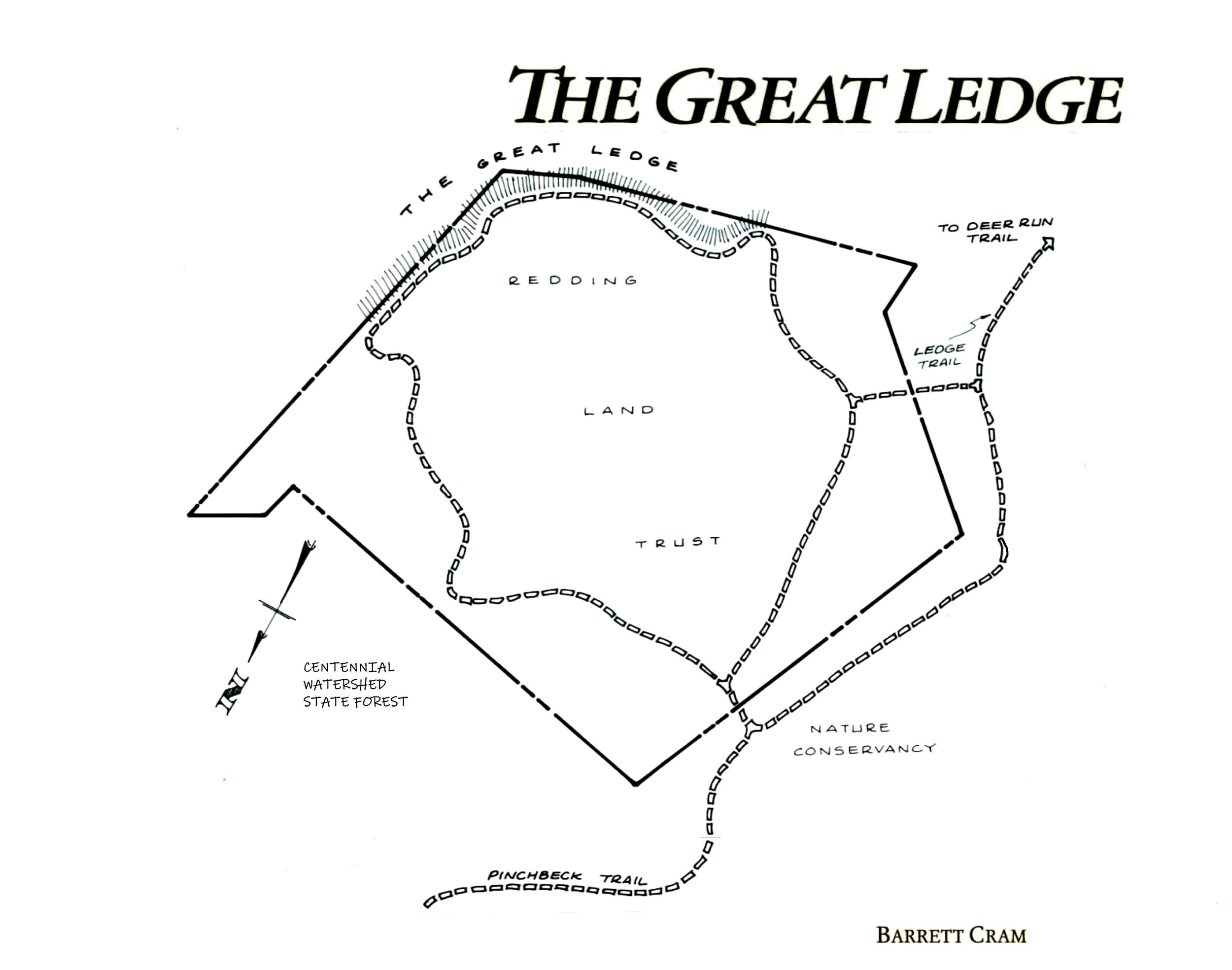
- Pinchbeck Trail
Great Ledge Loop
Background: How the Great Ledge was saved.
Key Features: The breathtaking views from the Great Ledge are described on the facing page. Suffice it to say that they rival the very best to be enjoyed from any promontory in southern New England. To relish the most dramatic effects, first-time visitors are encouraged to follow the Great Ledge loop in a clockwise direction.
A word about trail blazes: Both the Pinchbeck and the Great Ledge Trails are blazed in white. However, where the Pinchbeck enters Devil's Den, it may also carry the yellow blaze of The Nature Conservancy's marking system.
A word about nomenclature: Redding's Great Ledge is part of an escarpment that extends into Weston and the precincts of Devil's Den. Alas, folks down that way have historically called their part of the 'scarp "The Great Ledge" too. An impartial observer, however, would have to concede that, based on the quality of the view, Redding's half of the ledge is by far the greater. Therefore, with apologies to our neighbors South of the Border, we have arranged our signs and maps to celebrate this territorial superiority. Ours is The Great Ledge. Theirs is the Ledge. Go in peace. ❧