
Limekiln Natural Area, The Marcus Gift & Todd's Wood
- Ownership
- Limekiln (Town); Marcus, Todd's Wood, Anderson, (Land Trust)
- Acreage
- 183.5 (Town, 127; Land Trust, 56.5)
- Entrances
- Off north side of Limekiln Road, 0.2 mile west of Lonetown Road, through opening in stone wall
- Parking
- East of entrance, at edge of open field on north roadside
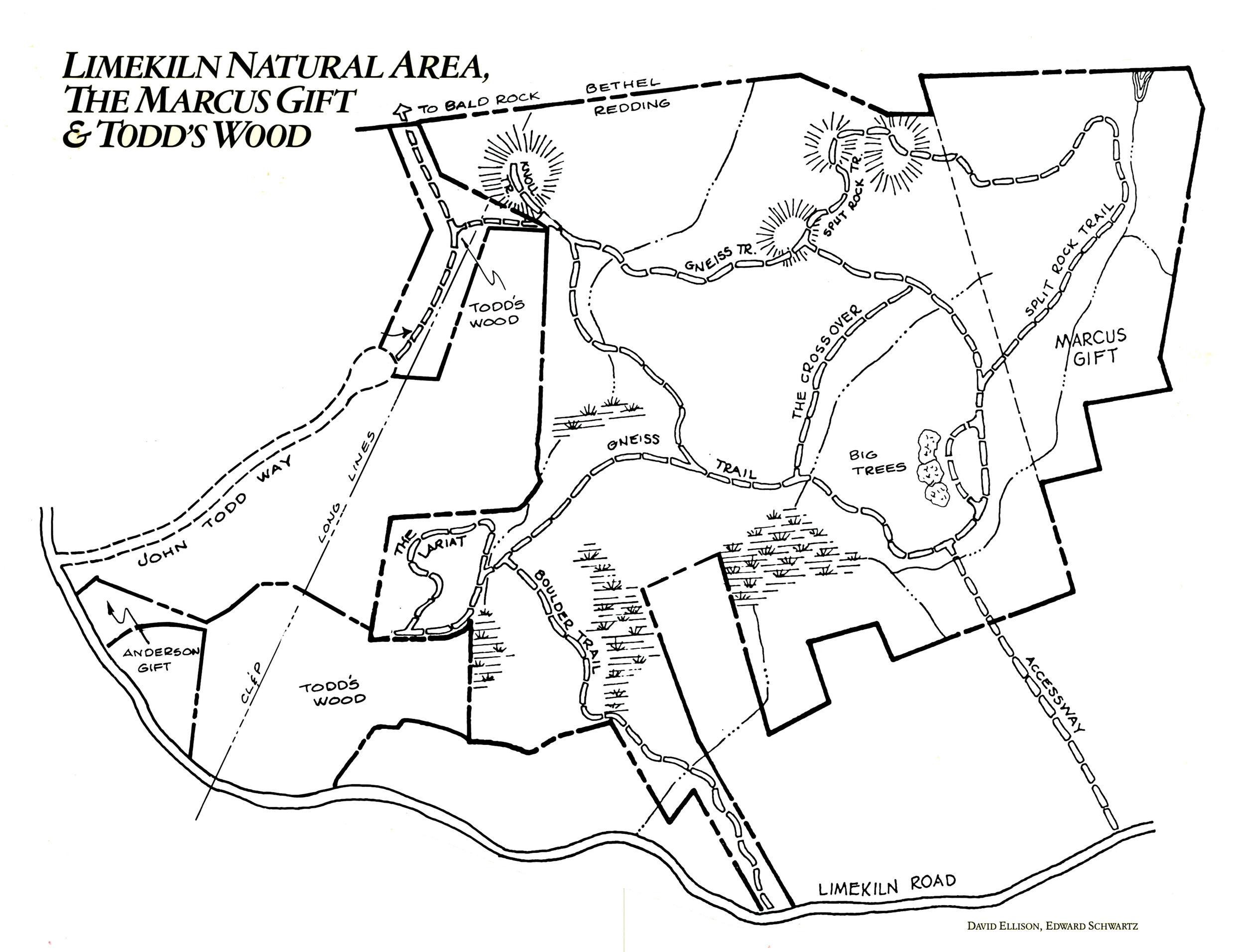
- Trails
- White blazes: Boulder, 0.5 mile; Gneiss, 1.5
Blue blazes: Split Rock, 0.67; Crossover, 0.15; The Lariat, 0.48; The Knoll, 0.15 Big Tree, 0.17; Accessway, 0.33; Todd's Wood, 0.25
Total all trails: 4.2 miles - Trail App
- Limekiln/Todds Way
Background: The natural area and the road giving access to it take their name from the limekiln operation that was located nearby in the early 19th century. One writer reports that all the hills in this vicinity "were stripped of firewood" to fuel the kiln, where limestone under intense heat was reduced to a powder used in the manufacturer of plaster. Redding acquired the property, known as the Mary Frances Jackson Purchase, in 1973. The Marcus Gift takes its name from Pearl and Jack Marcus, who donated 30 adjoining acres to the Land Trust in 1979.
Adjoining the west side of Limekiln Natural Area, Todd's Wood (in two separate parcels) was acquired by the Land Trust in 1989 through a subdivision setaside. And a year later, almost two acres were added to the southern section of the Wood through a gift to the Trust from Hjalmar Anderson. Much of the Limekiln Road area, including these tracts, was owned in the last century by various members of the Todd family, of whom Charles Burr Todd is best remembered for having written a history of Redding.
Key Features: In aggregate, it is mostly up-and-down country with a brook running through it, a splendid hardwood forest bouncing back from the lime-burning days, and enough twists and turns of a geological sort to satisfy the stoniest explorer.
From the opening in the wall, the Accessway-across property given to the Land Trust by the family of Judy and John Atwood-follows blazes to the natural area and a junction with the Gneiss Trail. (The Boulder Trail—so named for the huge glacial erratic it passes—also gives access from Limekiln Road, some 300 yards farther west, but parking is virtually impossible there.) The Gneiss—that's pronounced nice, in tribute to the very nice outcroppings throughout the area—is the primary trail, and for much of its way it follows the path of an old wood road.
For a longer stroll, hit out for the Split Rock Trail, which links the natural area to the Land Trust property. Along the way, you'll encounter Split Rock itself, a giant boulder brought forth by some long-ago ice-sheet and left perched on the top of a knoll. Time and the elements have since cut a slice through the boulder. The trail also passes a glacial kettle and a twin-trunk sugar maple of venerable age and near-record girth.
At the northwest comer of the Town/Trust properties, the Todd's Wood Trail strikes out a quarter mile to Bald Rock, just over the Bethel town line. This high lookout point commands a sweeping view of Bogus Mountain nearby and—on the sort of clear day when one is supposed to see "forever"—the faraway foothills of the Taconic and Berkshire uplands. South from Bald Rock, the trail leads along the powerline cut to a parking strip on John Todd Way. ❧